Colorado State University released its initial 2026 Atlantic hurricane forecast on April 9, projecting 13 named storms, 6 hurricanes, and 2 major hurricanes. The numbers land below the 30-year average of 14.4 named storms, 7.2 hurricanes, and 3 major hurricanes. Phil Klotzbach, the forecast's lead author, and co-authors Delian Colon-Burgos and Michael Bell presented the data at a Thursday press conference, with Klotzbach noting that "curveballs could come our way."
How Does El Nino Drive the Below-Average Prediction?
CSU projects 13 named storms, 6 hurricanes, and 2 major hurricanes for the 2026 Atlantic season, against a 30-year average of 14.4 named storms and 7.2 hurricanes.
Verified
The forecast rests on one dominant variable: the anticipated arrival of El Nino. NOAA's Climate Prediction Center assigns a 61% probability that El Nino will emerge between May and July 2026. During El Nino events, increased vertical wind shear across the Atlantic basin disrupts tropical cyclone formation. The mechanism is well-documented. Stronger upper-level westerly winds tear apart the vertical structure that developing storms need to intensify.
Timeline
April 9, 2026 -- CSU releases its initial 2026 Atlantic hurricane season forecast, the earliest seasonal outlook the program issues.
CSU's models project that El Nino will reach full strength during the August-through-October peak of hurricane season. If that timeline holds, the suppression effect should be pronounced. The team estimates total seasonal activity at approximately 75% of the long-term average.
Who
Phil Klotzbach -- Lead author of the CSU seasonal hurricane forecast and senior research scientist at Colorado State University.
CSU's April Forecast: Modest Skill, High Visibility
NOAA's Climate Prediction Center assigns a 61% probability of El Nino emerging between May and July 2026.
Verified
 Bipi News
Talk to The Reporter
The Technocrat
Systems thinker who trusts data, institutions, and expertise. Sees most problems as solvable through better design, not ideology.
First call is free. 5 minutes, no sign-up required.
CSU describes its April forecast as the earliest seasonal outlook it issues and acknowledges it carries "modest long-term skill." The phrasing matters. A forecast with modest skill performs better than climatology (simply predicting the average) but leaves substantial room for error. Sea surface temperature trends in the Atlantic are sending what Colon-Burgos called "a bit of a mixed signal," and those trends will determine whether the June and August updates shift the numbers higher or lower.
Bill Gray launched CSU's seasonal hurricane forecasting program in 1984. Over four decades, the April forecast has shown limited predictive power for individual storm counts but reasonable skill at categorizing seasons as above or below average. The program's real value lies in forcing emergency managers and coastal communities to begin preparations months before the June 1 season start.
13 Named Storms Against 14.4: What the Baseline Actually Shows
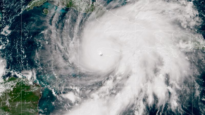
The 30-year average has shifted upward in recent years. NOAA's current baseline (1991-2020) puts the average at 14 named storms, 7 hurricanes, and 3 major hurricanes. CSU uses a slightly different averaging period, arriving at 14.4 named storms and 7.2 hurricanes. The 2025 season produced 13 named storms, 5 hurricanes, and 4 major hurricanes, with no direct U.S. landfalls. Jamaica absorbed the worst damage from Category 5 Hurricane Melissa.
CSU assigns a 32% probability of major hurricane U.S. landfall in 2026, below the long-term average of approximately 43%.
Verified
Bipi NewsThink Further on BIPI.
Unlimited access to your personalized investigative reporter agent, sourcing real-time and verified reports on any topic. Your personalized news feed starts here.
Learn moreA below-average season by count does not mean a low-impact season. The 2025 season illustrates this: it matched 2026's projected storm count but included four major hurricanes. As Bell stated in the CSU press release, "It takes only one storm near you to make this an active season for you."
The Landfall Probability Numbers
CSU assigns a 32% probability of a major hurricane making U.S. landfall in 2026 and a 35% probability for Caribbean landfall. Those figures sit below the long-term averages of approximately 43% and 42%, respectively. The reduction tracks with the lower projected storm count, but landfall prediction carries even less skill than seasonal storm count prediction. Steering patterns, which depend on mid-latitude weather systems weeks or months into the future, remain beyond reliable forecasting at this lead time.
What Would Falsify the Below-Average Forecast?
Bipi NewsKnow someone who should read this?
Share this report with a friend who values evidence-based journalism.
Two variables could push the season above average. First, if El Nino fails to materialize or arrives late, the wind shear suppression would weaken or vanish. The Climate Prediction Center's 61% probability means a 39% chance that neutral or even La Nina-like conditions persist into summer. Second, Atlantic sea surface temperatures could rise sharply. Warmer ocean water provides more energy for tropical cyclone development. If Atlantic SSTs climb to 2024-level anomalies while El Nino stalls, the forecast's foundation erodes.
CSU will update the forecast in June and again in August. NOAA releases its own seasonal outlook in May. The convergence or divergence of these outlooks will reveal how much confidence forecasters have as the data picture sharpens.
The evidence supports a somewhat quieter season. The El Nino signal is the strongest single predictor in CSU's statistical model, and it points toward suppressed activity. But modest skill means exactly that. Coastal residents and emergency managers should treat the forecast as a planning input, not a guarantee. The mechanism is sound. The precision is not.